District and ward maps
Ward maps and Town, Parish and Community Council maps are available to download from this page as jpeg images.
| File icon | Description | File size |
|---|---|---|
 |
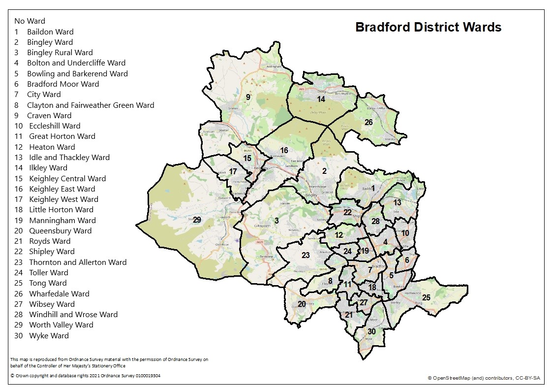
Bradford District ward map | 1 Mb |
|
|
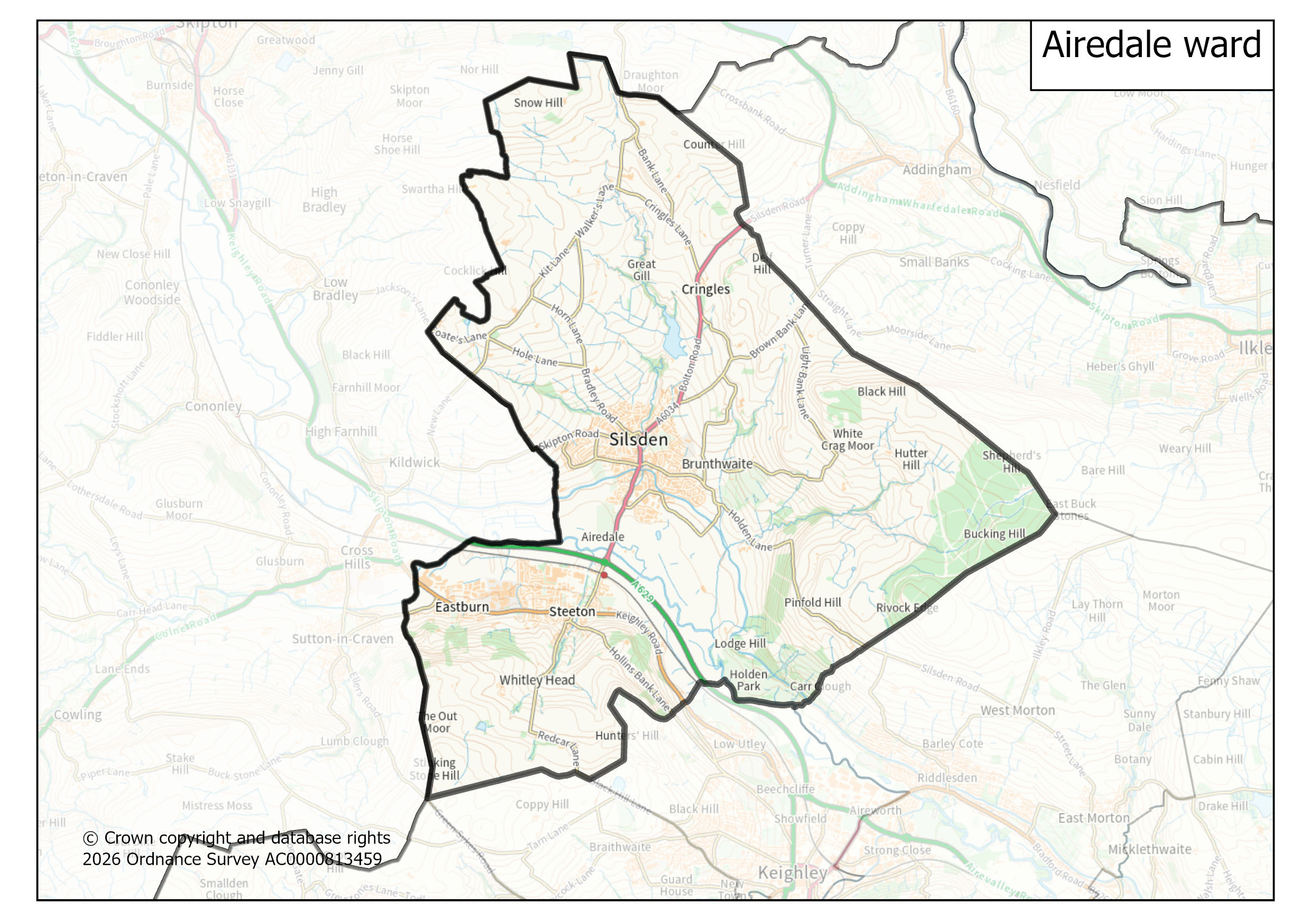
Airedale ward map | 651 Kb |
|
|
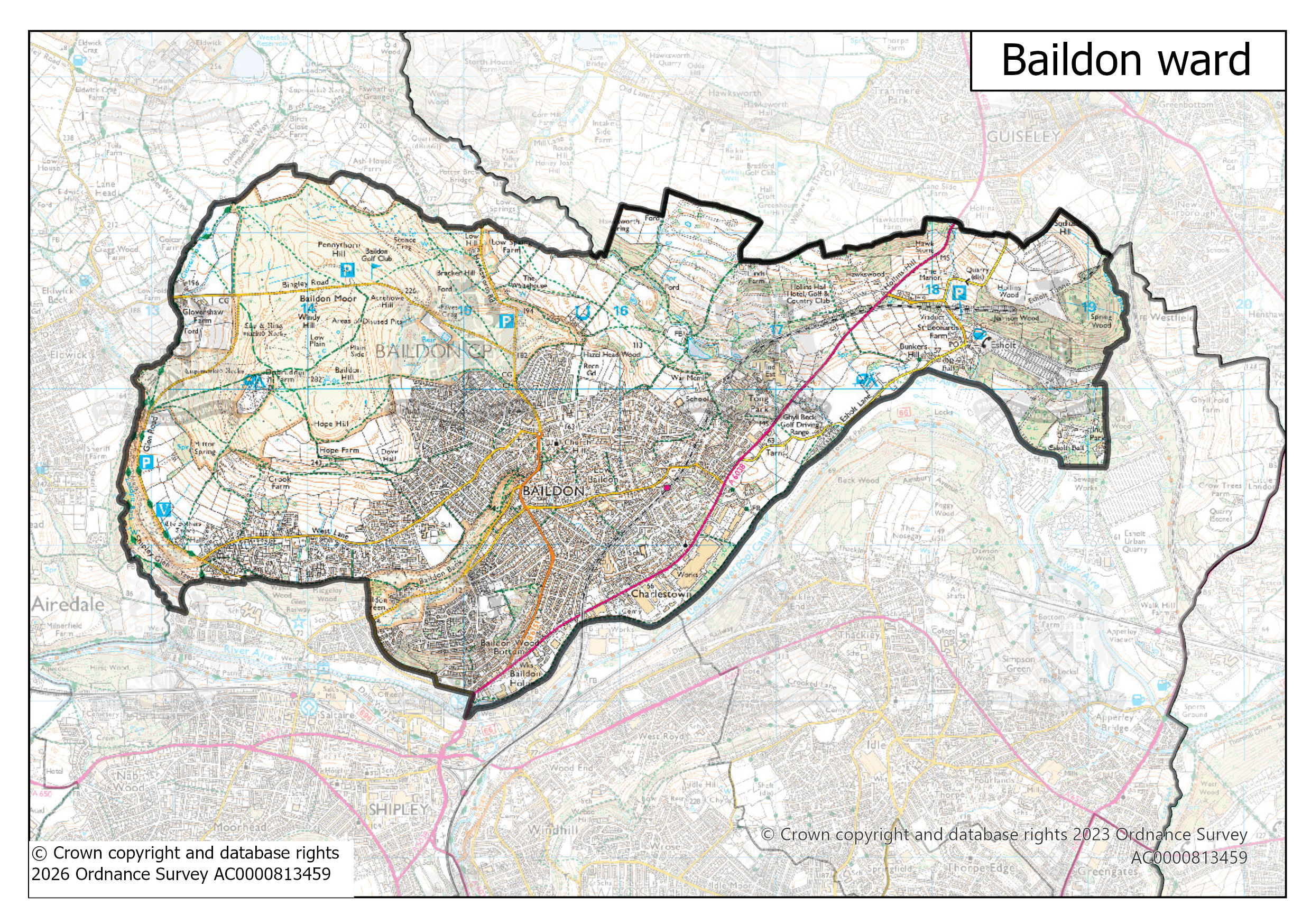
Baildon ward map | 1 Mb |
|
|
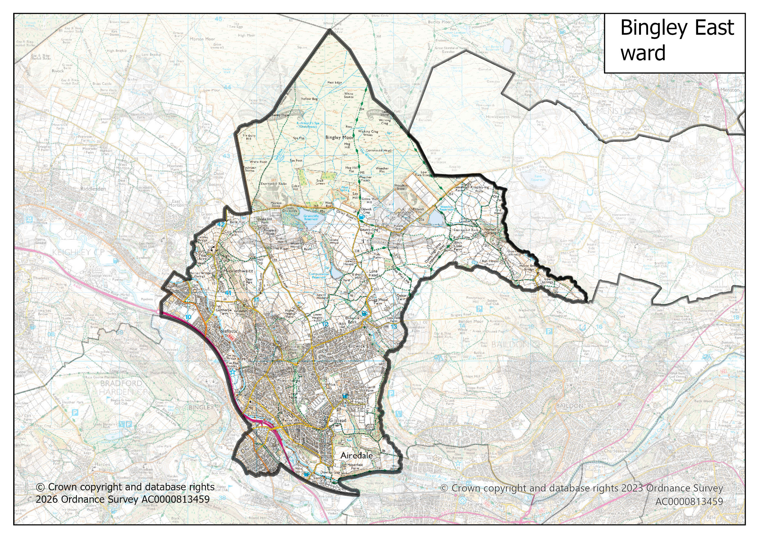
Bingley East ward map | 1 Mb |
|
|
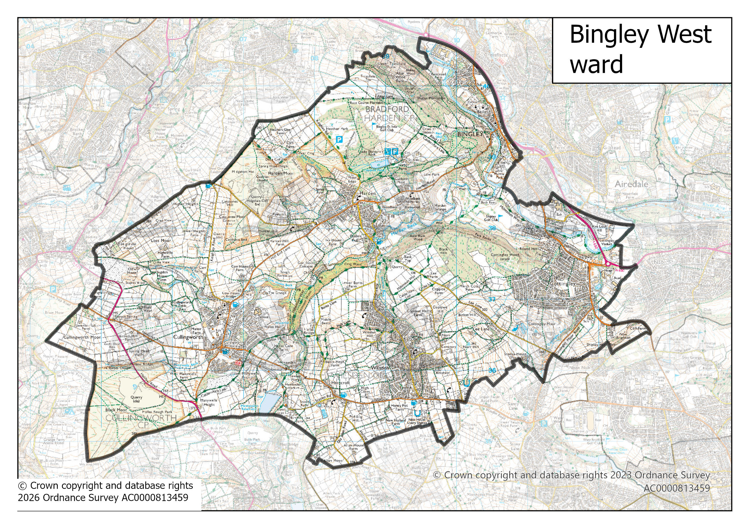
Bingley West ward map | 1 Mb |
|
|
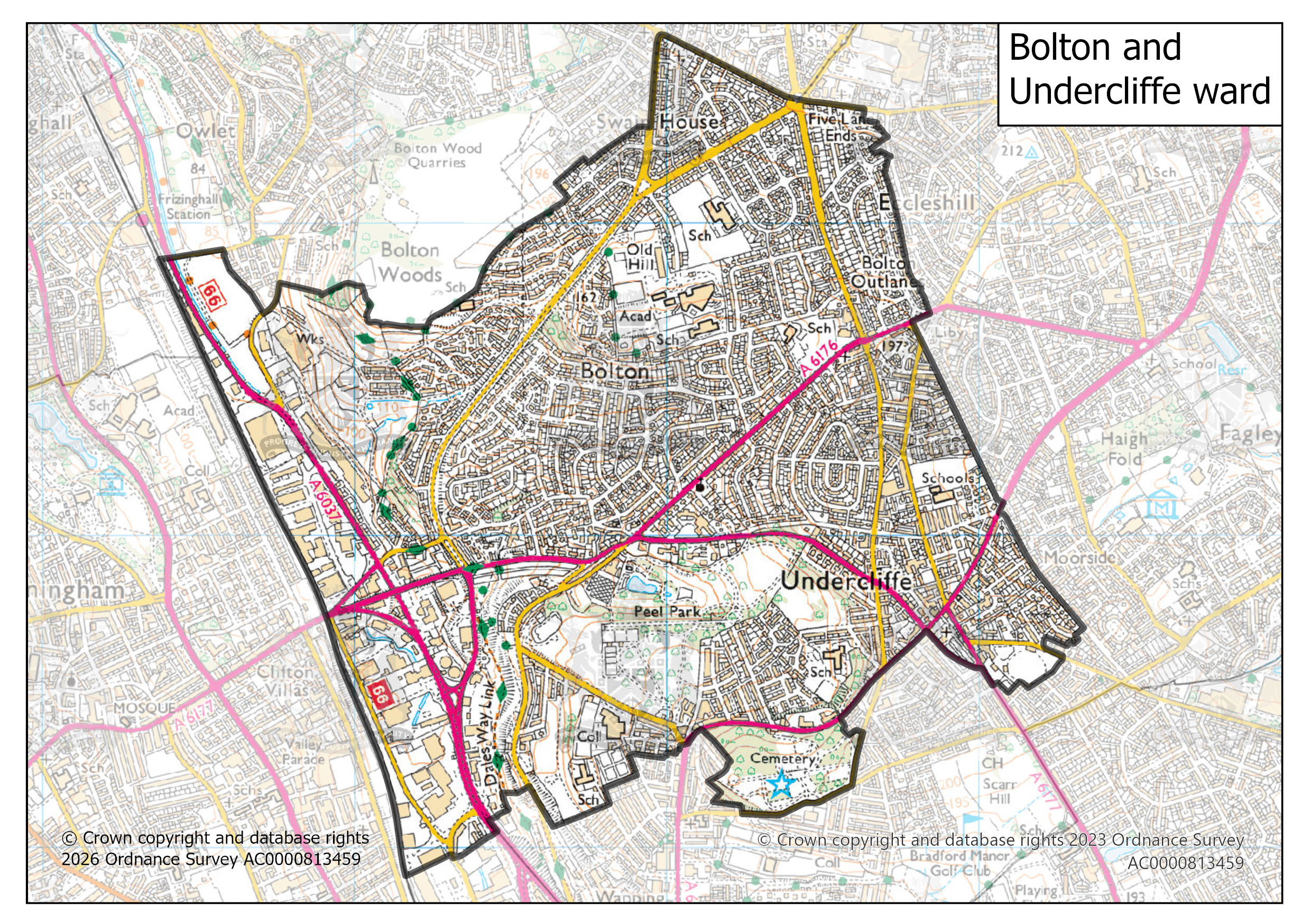
Bolton and Undercliffe ward map | 1 Mb |
|
|
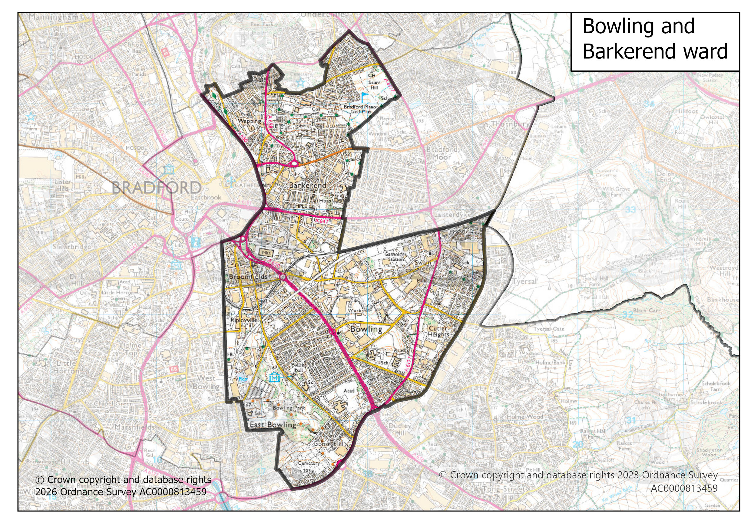
Bowling and Barkerend ward map | 1 Mb |
|
|
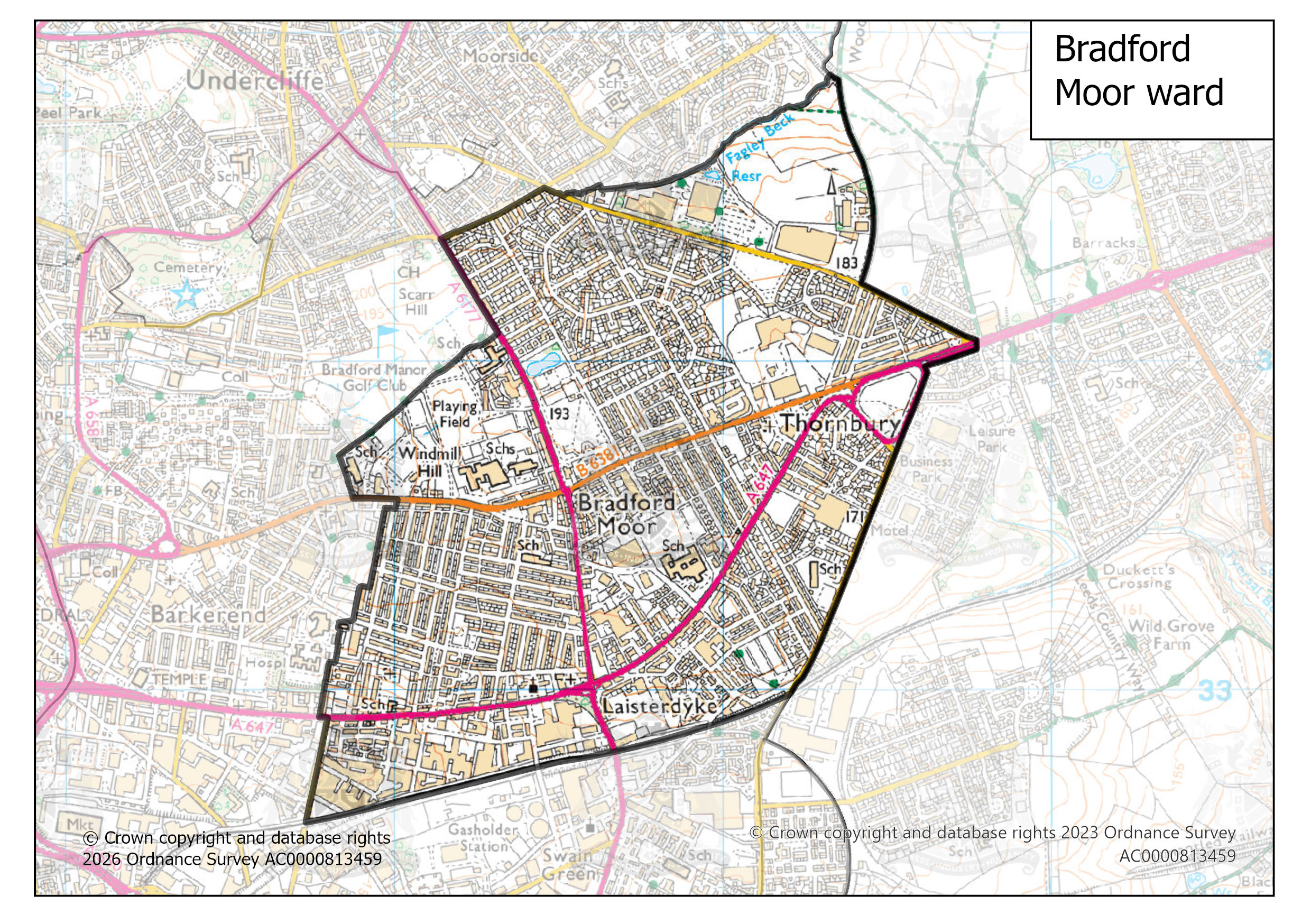
Bradford Moor ward map | 1 Mb |
|
|
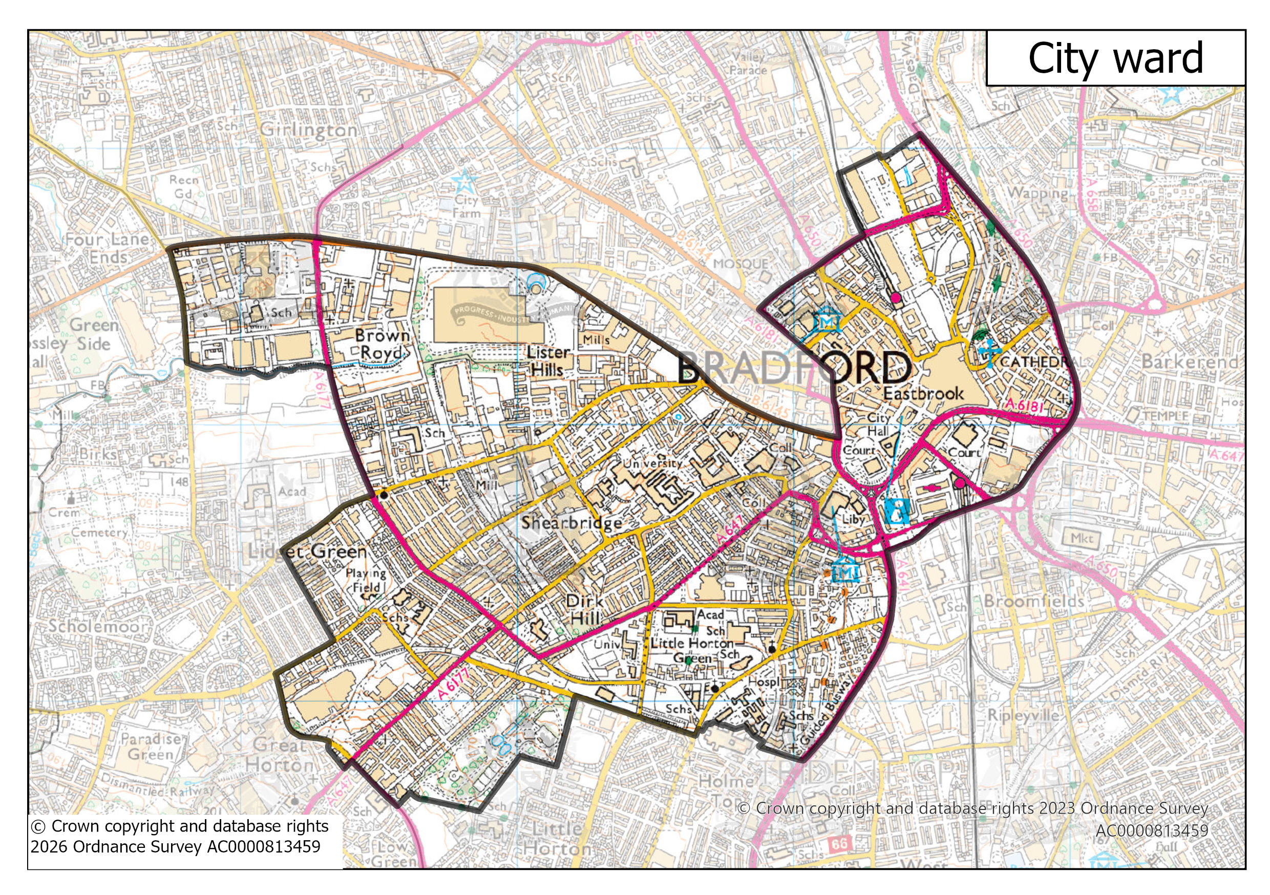
City ward map | 1 Mb |
|
|
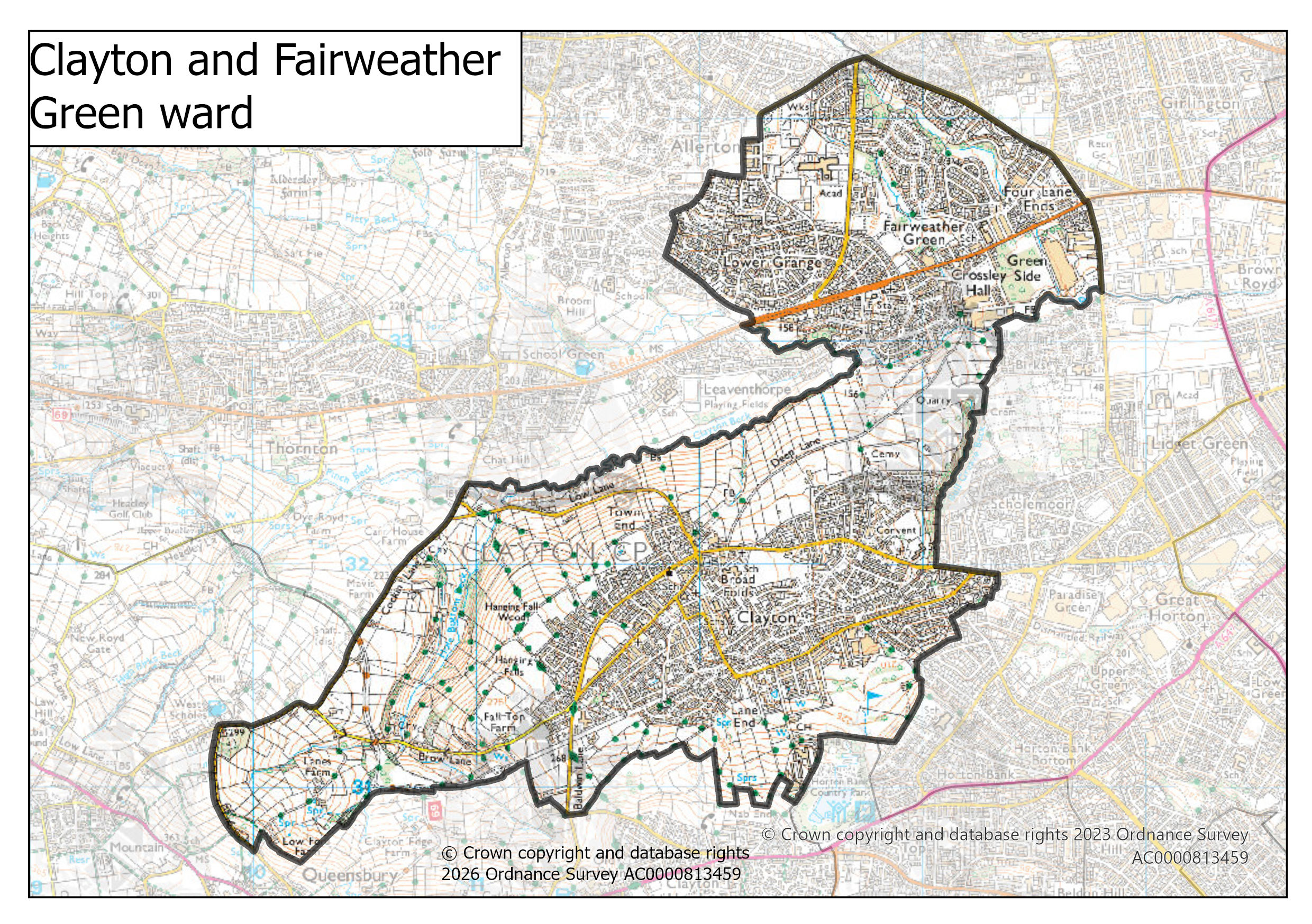
Clayton and Fairweather Green ward map | 1 Mb |
|
|
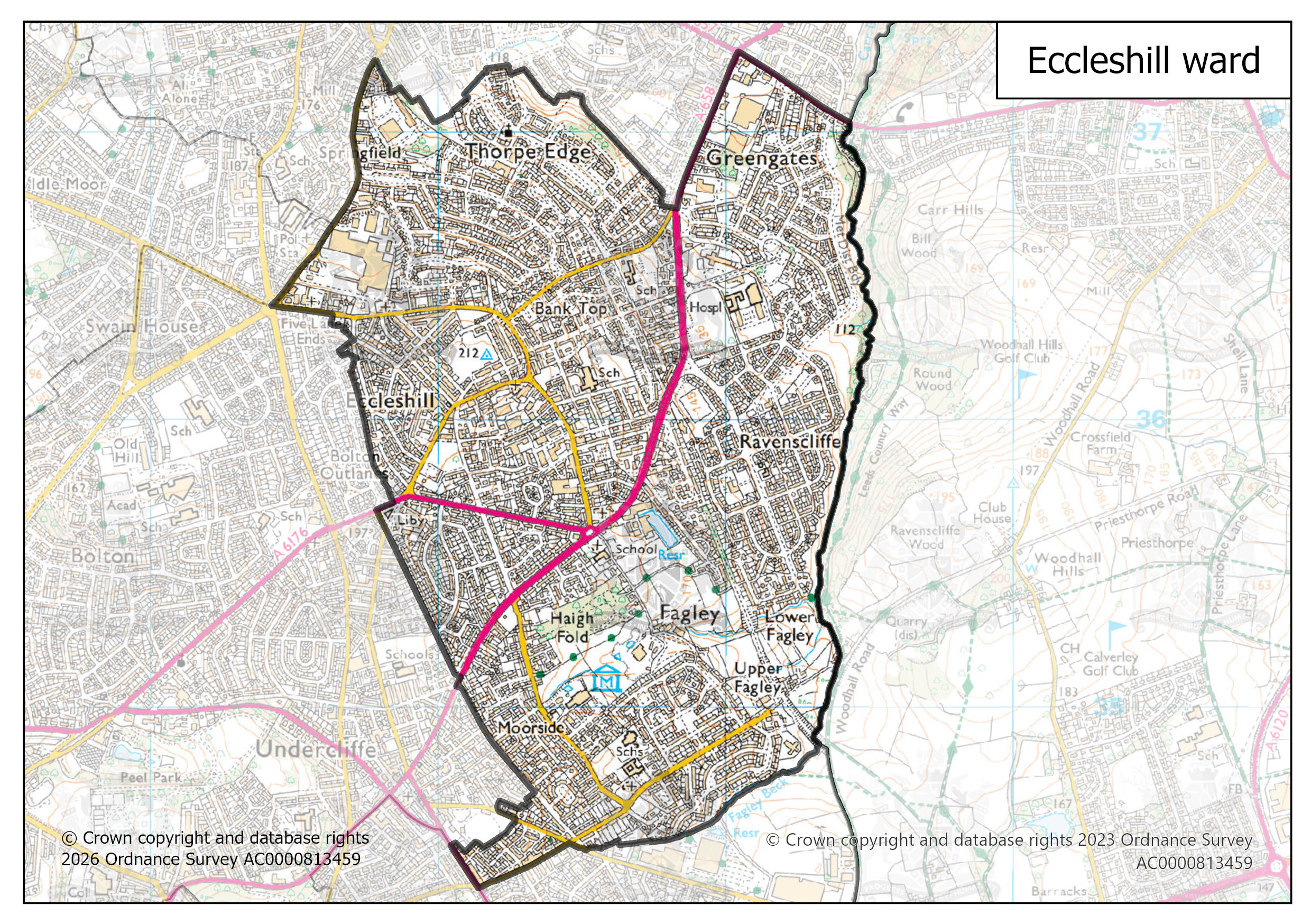
Eccleshill ward map | 1 Mb |
|
|
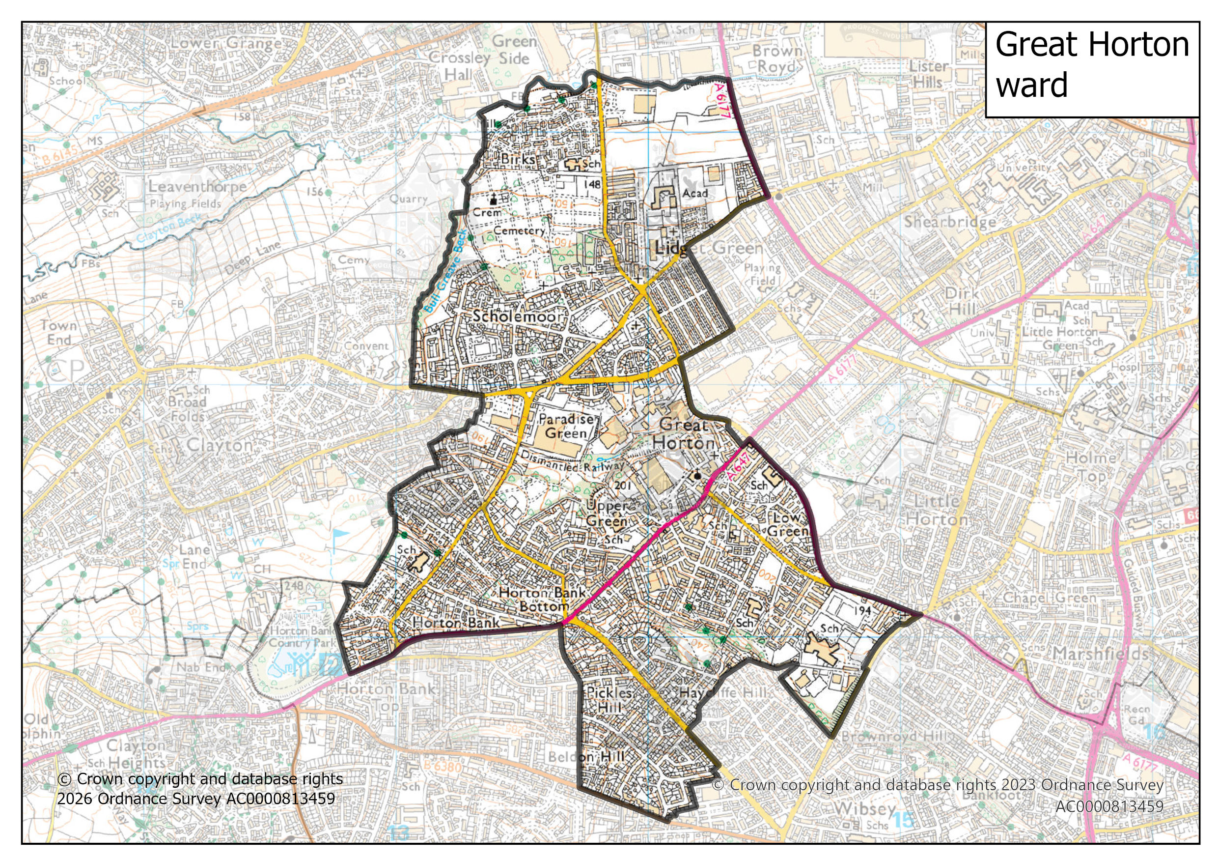
Great Horton ward map | 1 Mb |
|
|
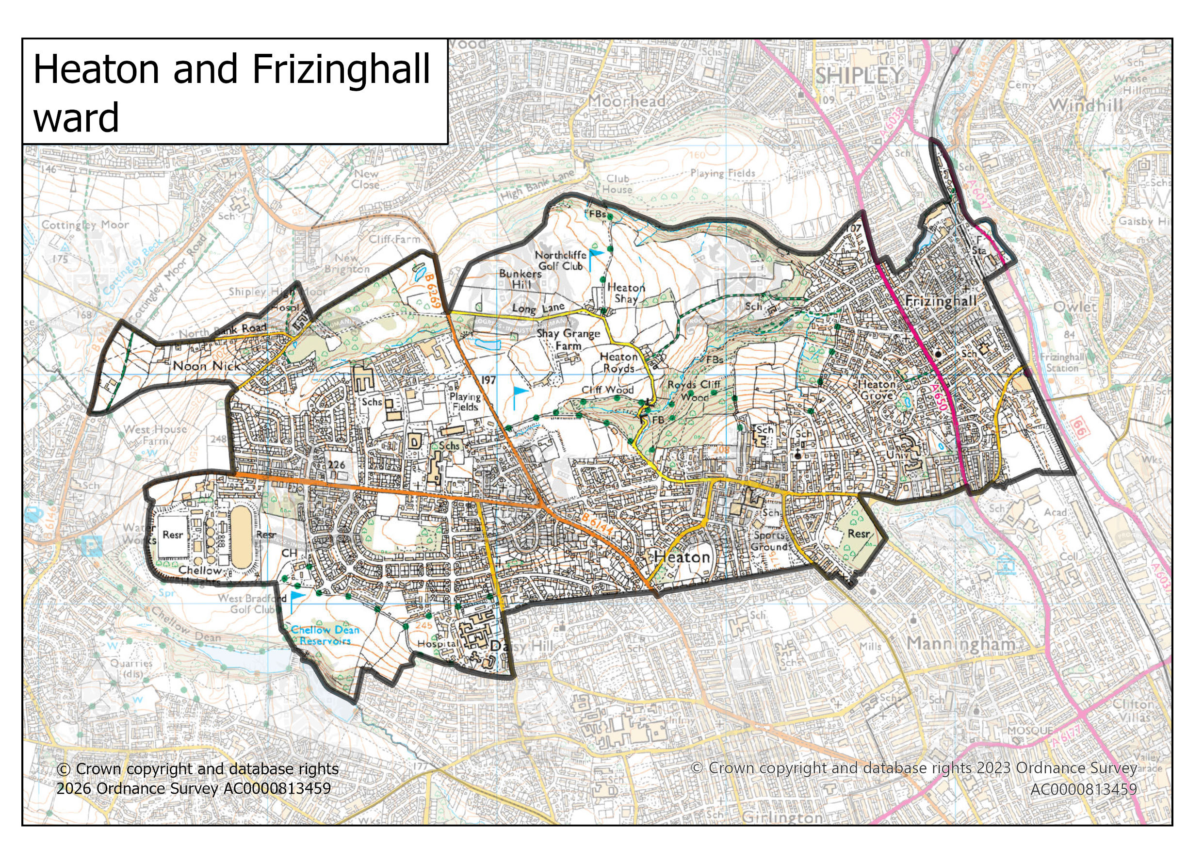
Heaton and Frizinghall ward map | 1 Mb |
|
|
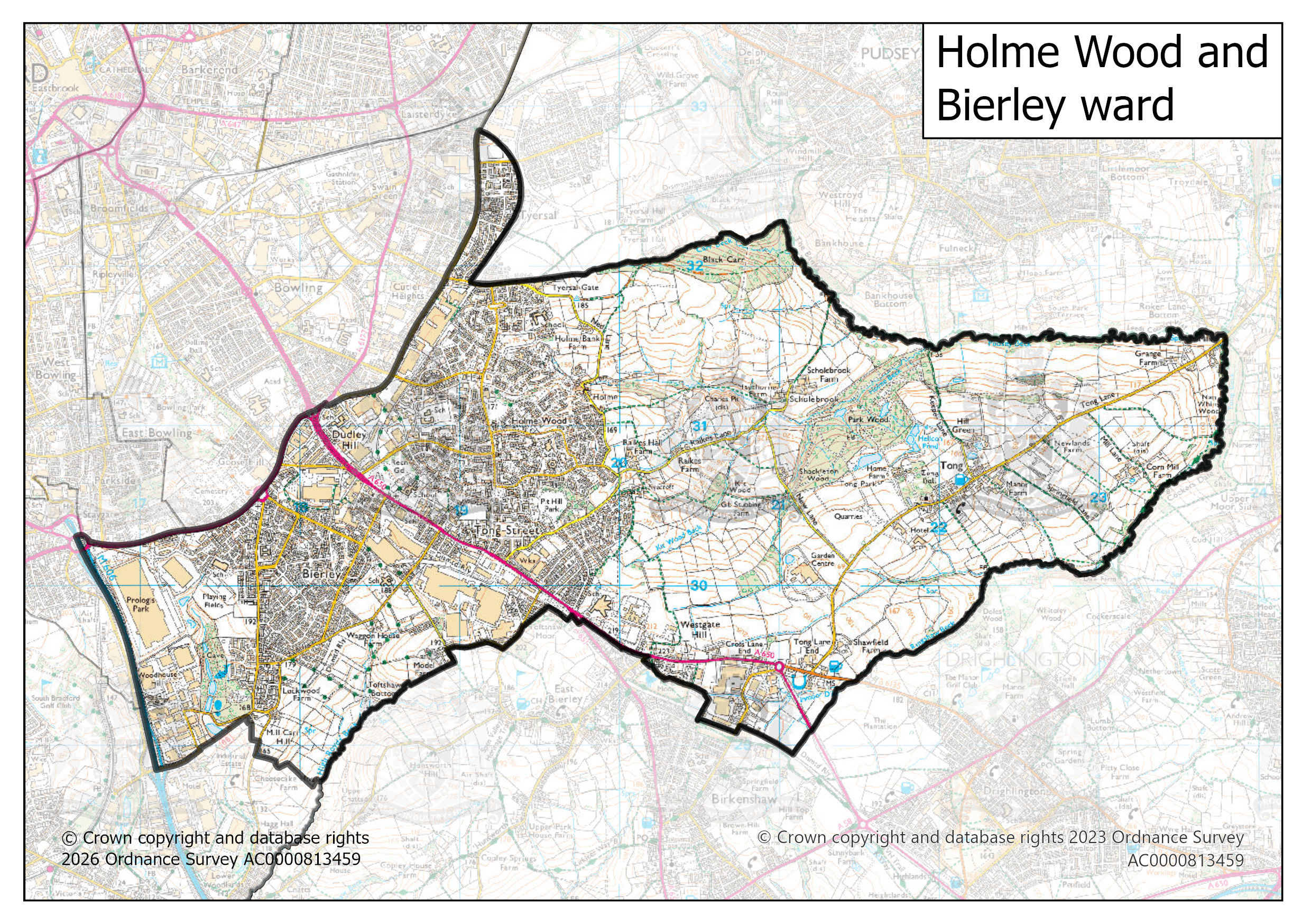
Holme Wood and Bierley ward map | 1 Mb |
|
|
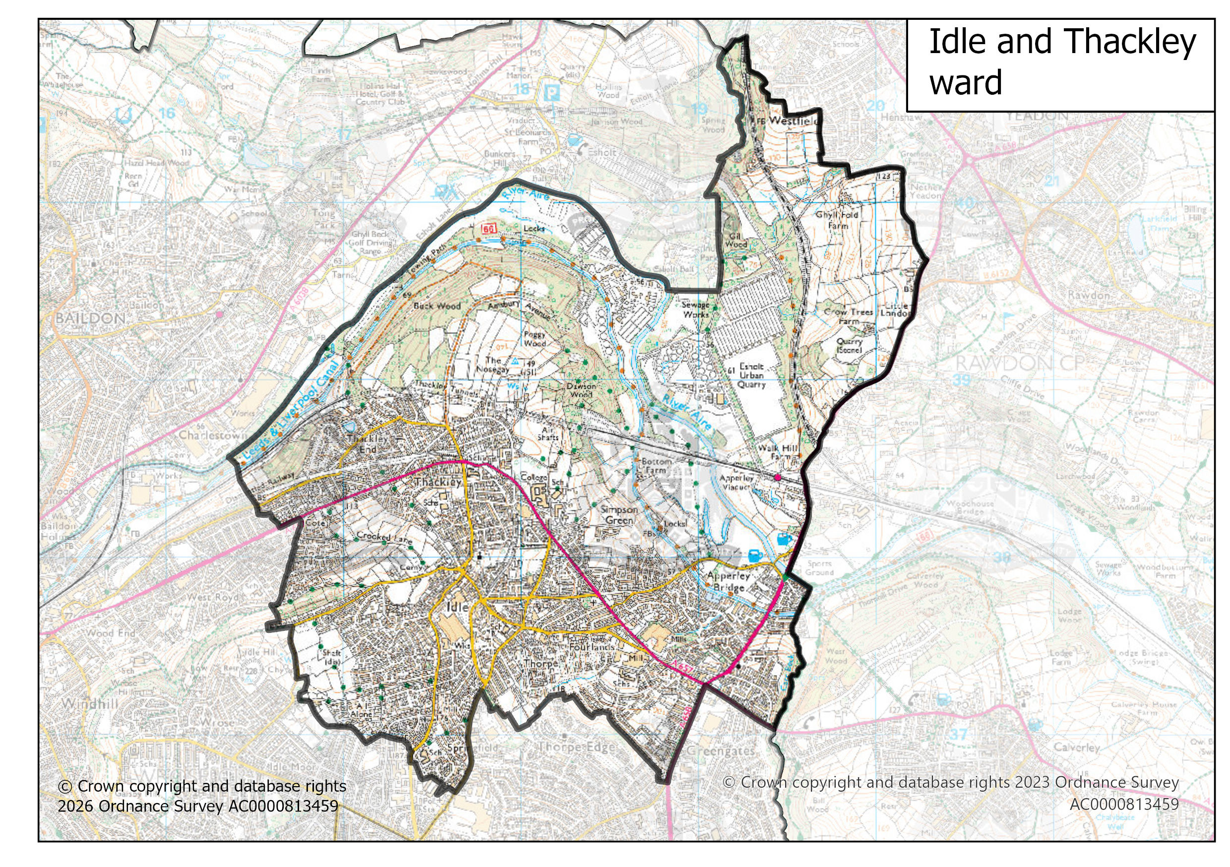
Idle and Thackley ward map | 1 Mb |
|
|
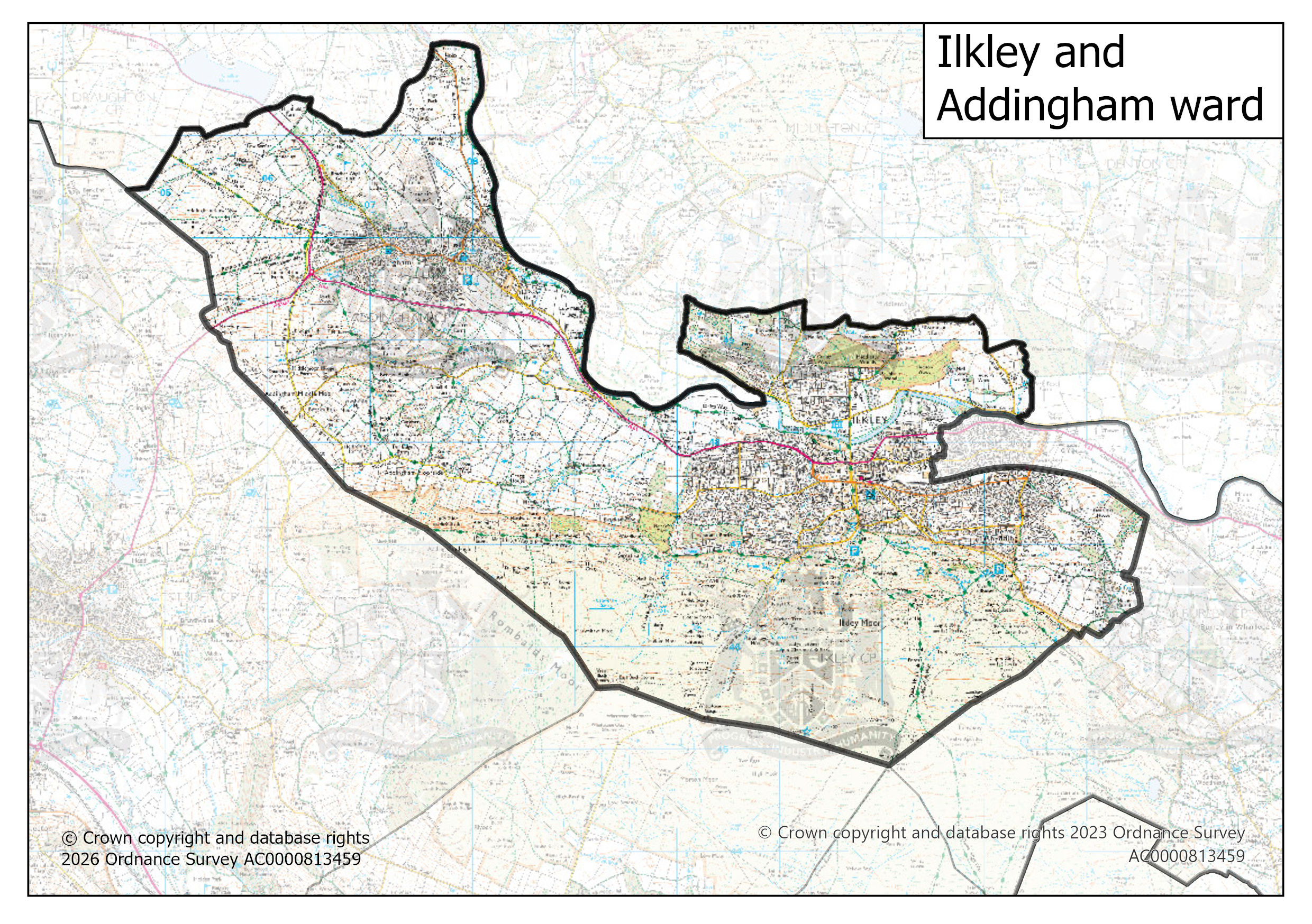
Ilkley and Addingham ward map | 1 Mb |
|
|
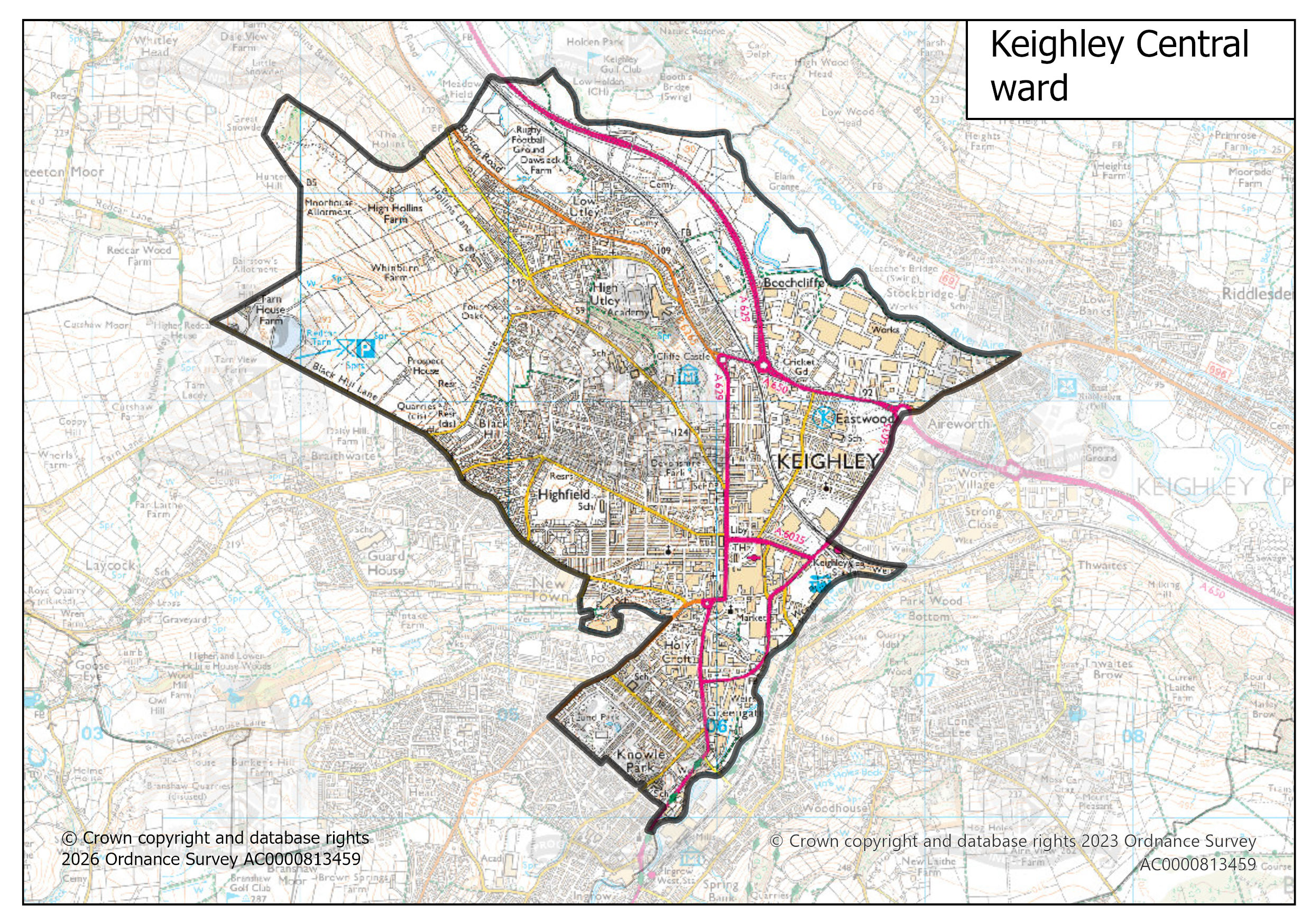
Keighley Central ward map | 1 Mb |
|
|
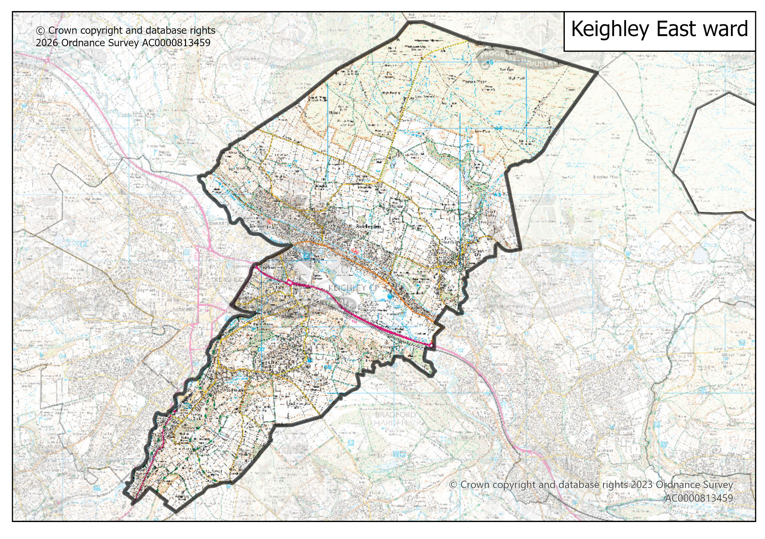
Keighley East ward map | 1 Mb |
|
|
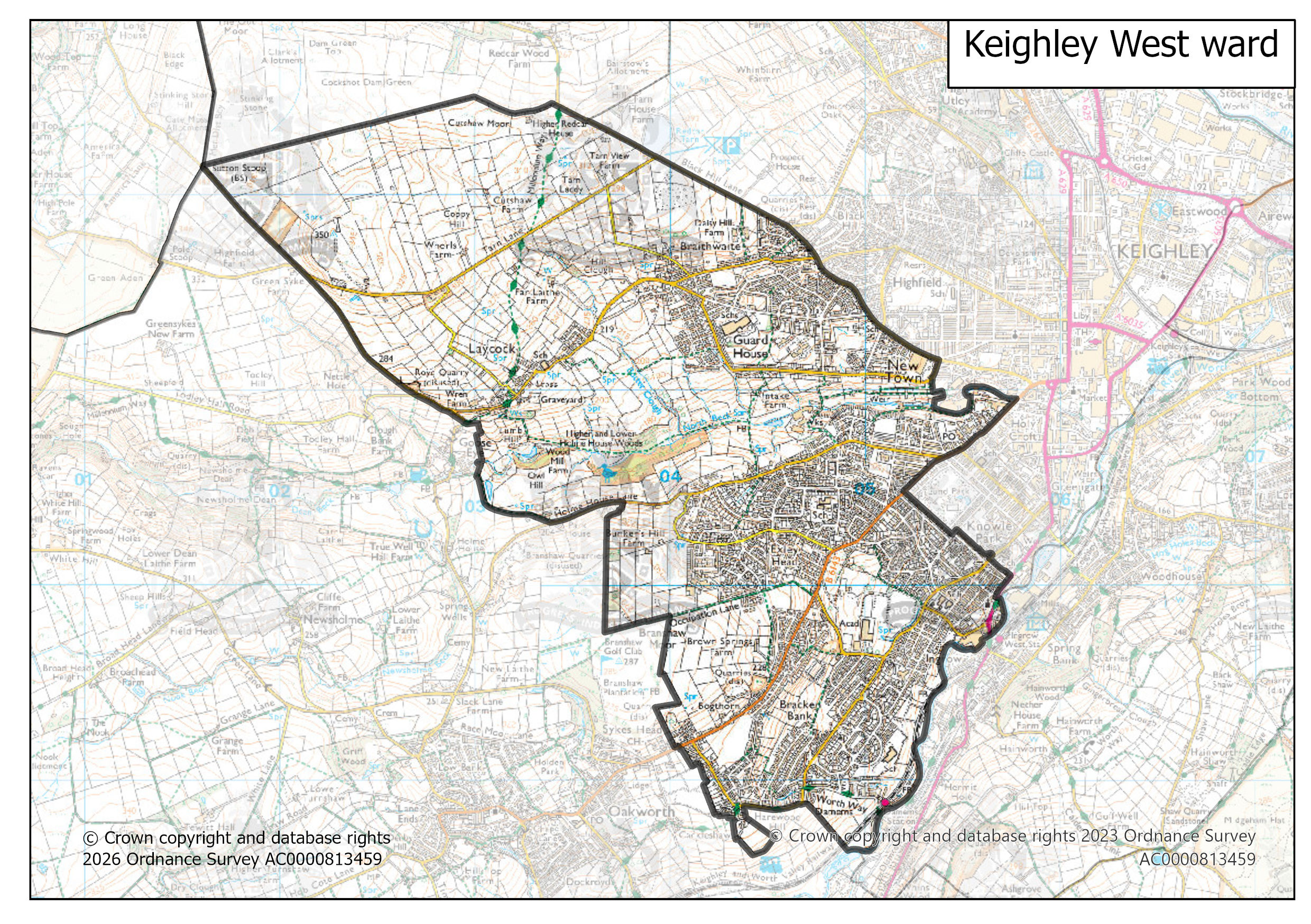
Keighley West ward map | 1 Mb |
|
|
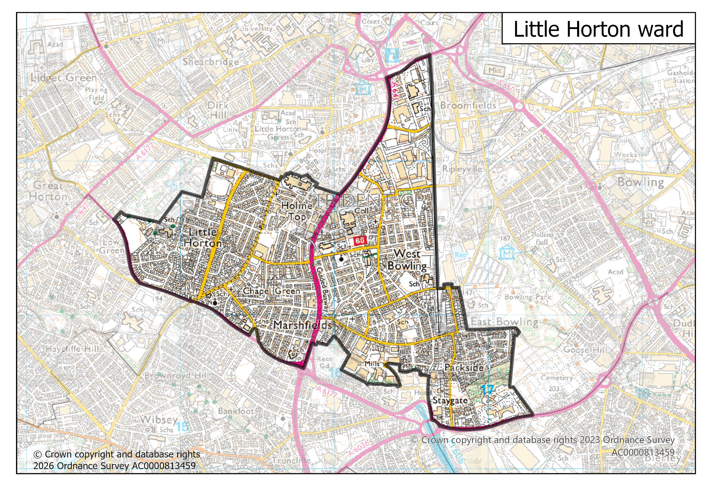
Little Horton ward map | 1 Mb |
|
|
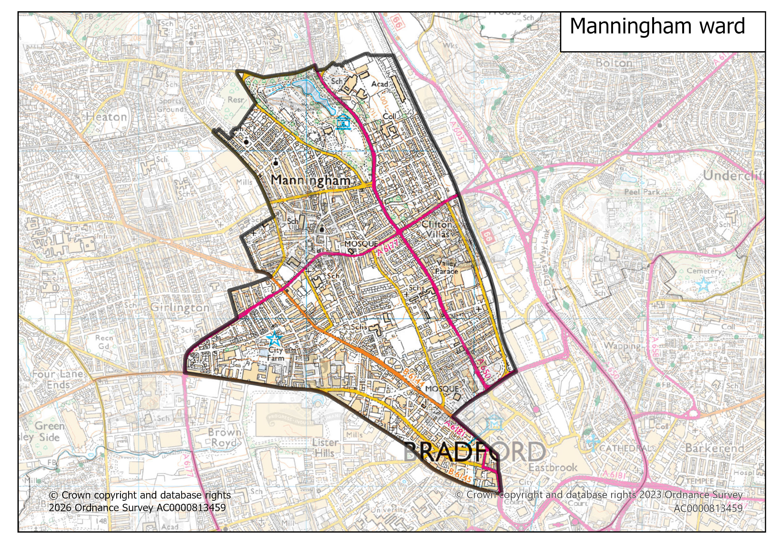
Manningham ward map | 1 Mb |
|
|
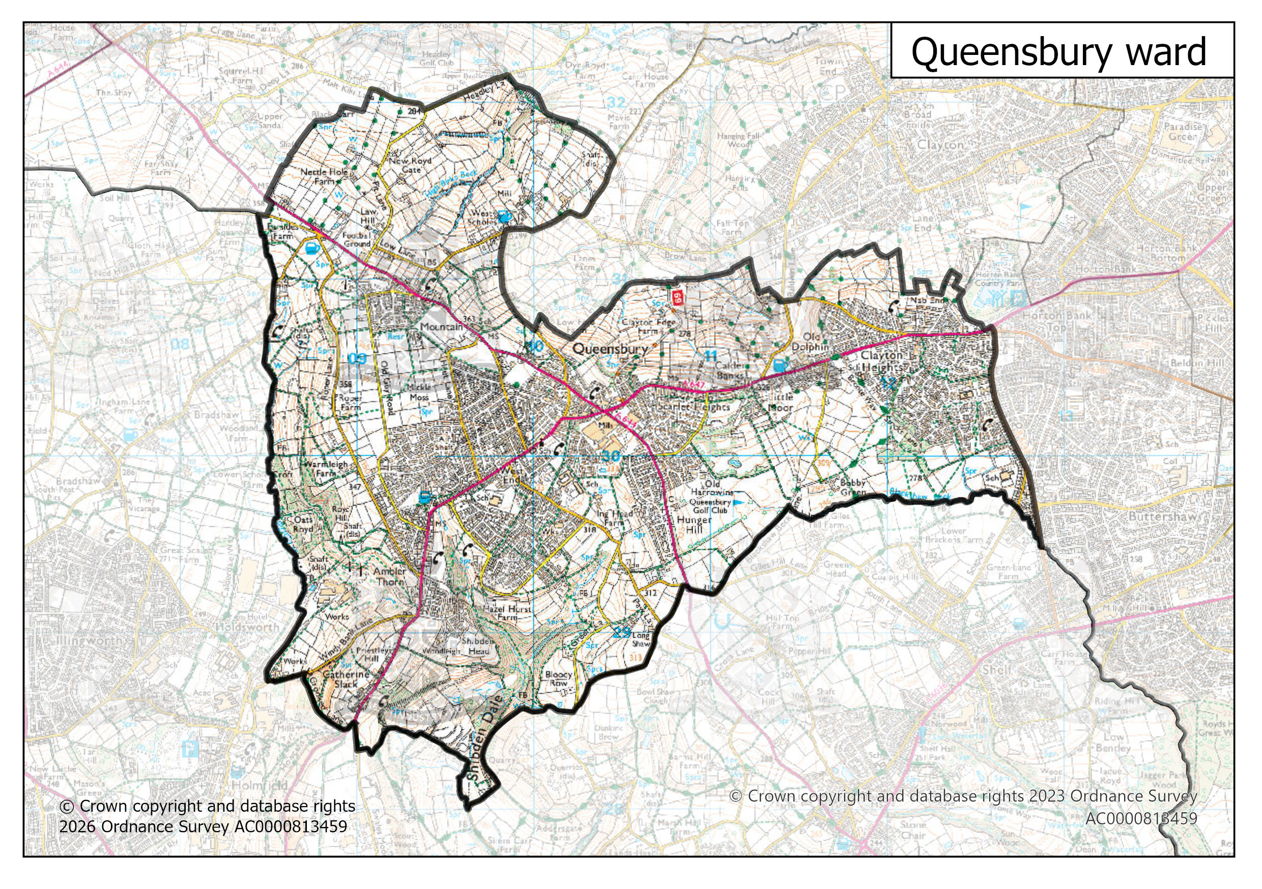
Queensbury ward map | 1 Mb |
|
|
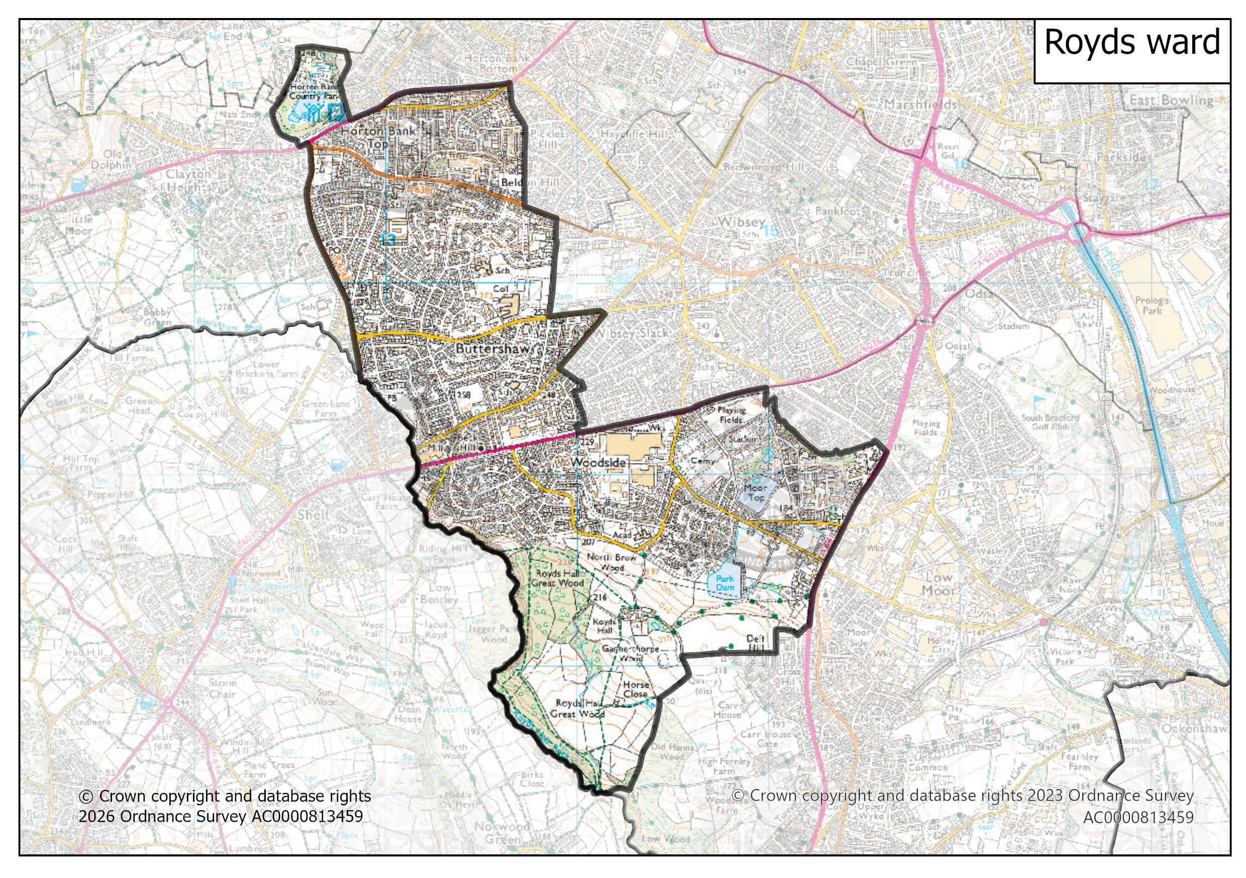
Royds ward map | 1 Mb |
|
|
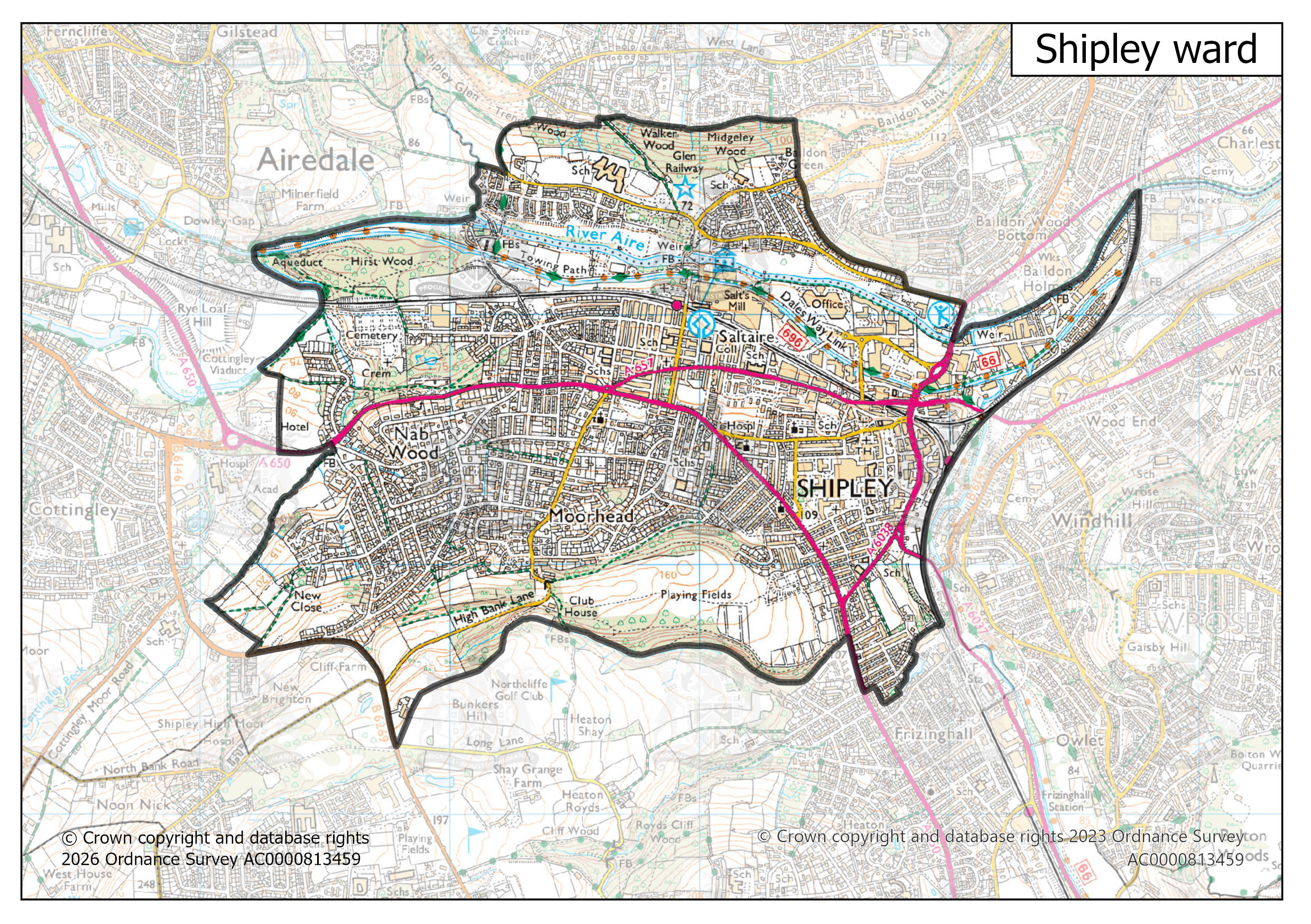
Shipley ward map | 1 Mb |
|
|
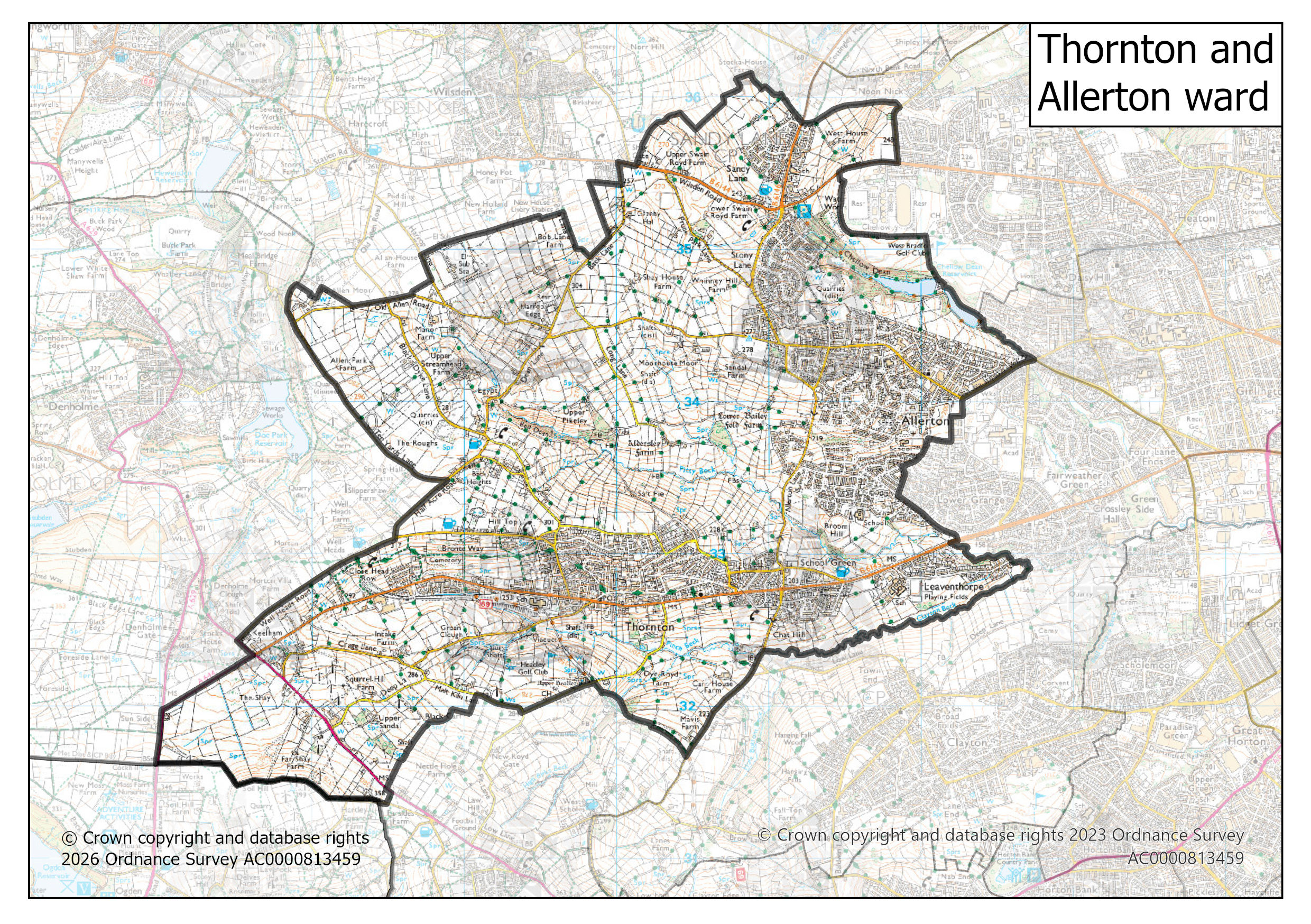
Thornton and Allerton ward map | 1 Mb |
|
|
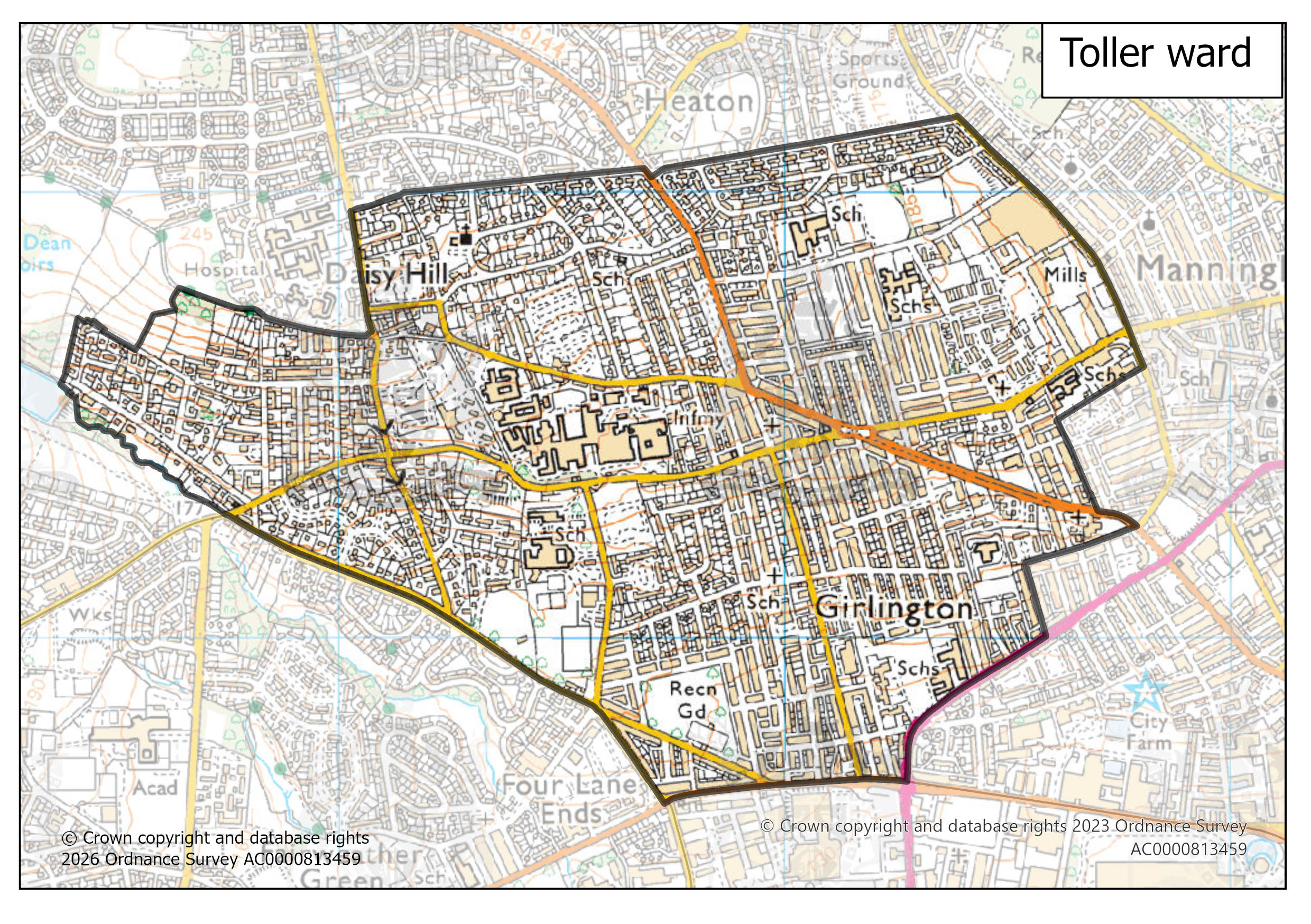
Toller ward map | 1 Mb |
|
|
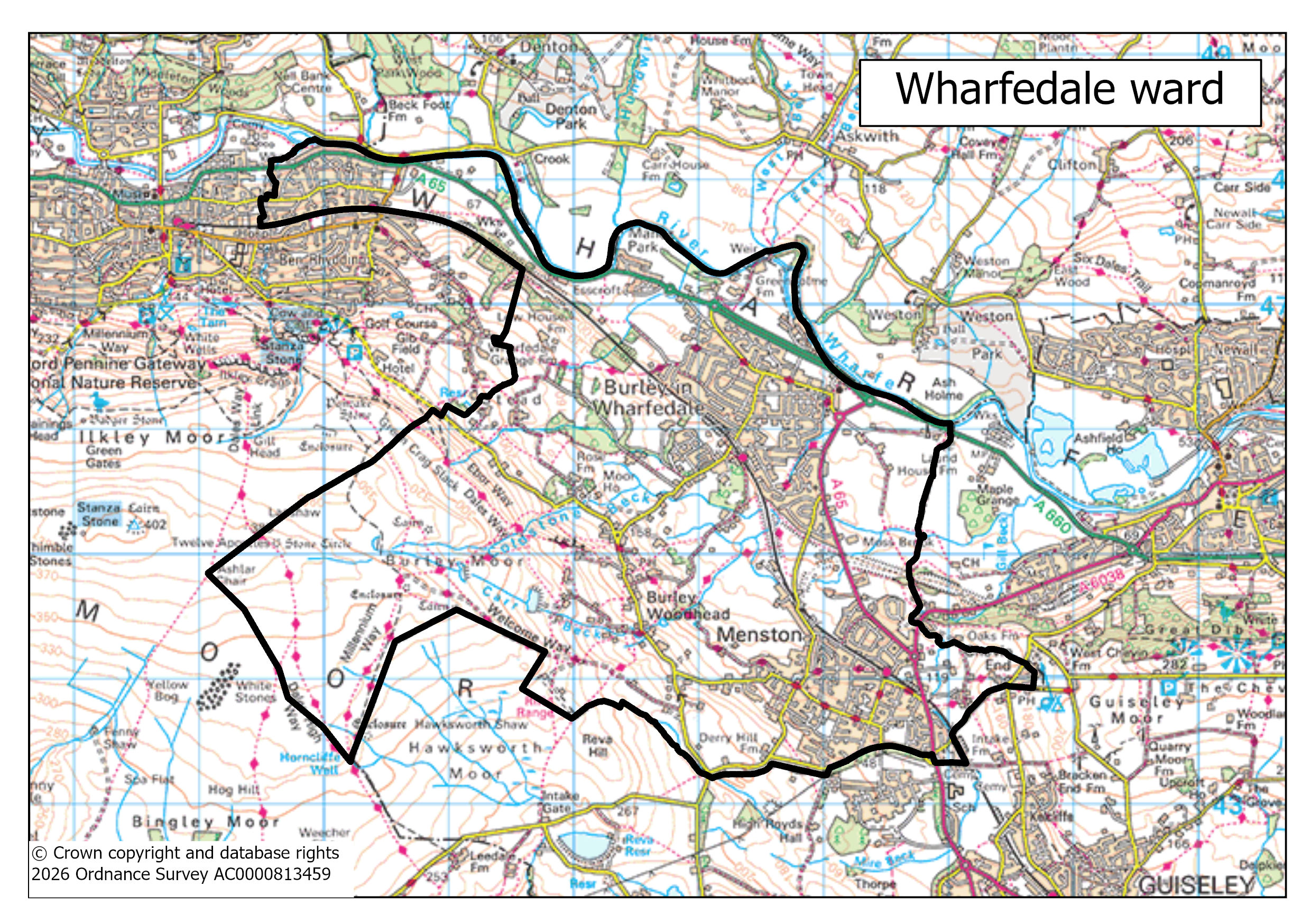
Wharfedale ward map | 1 Mb |
|
|
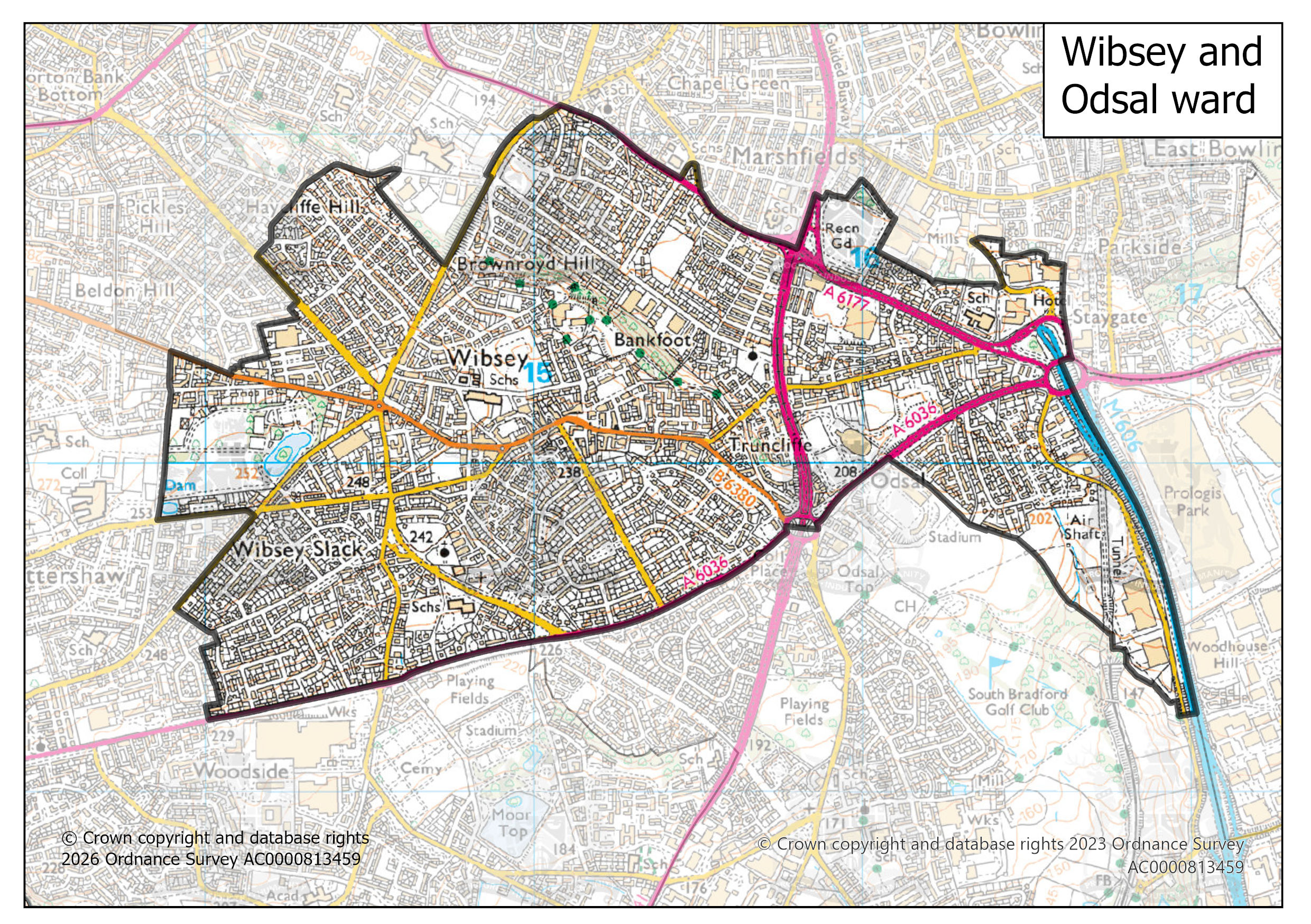
Wibsey and Odsal ward map | 1 Mb |
|
|
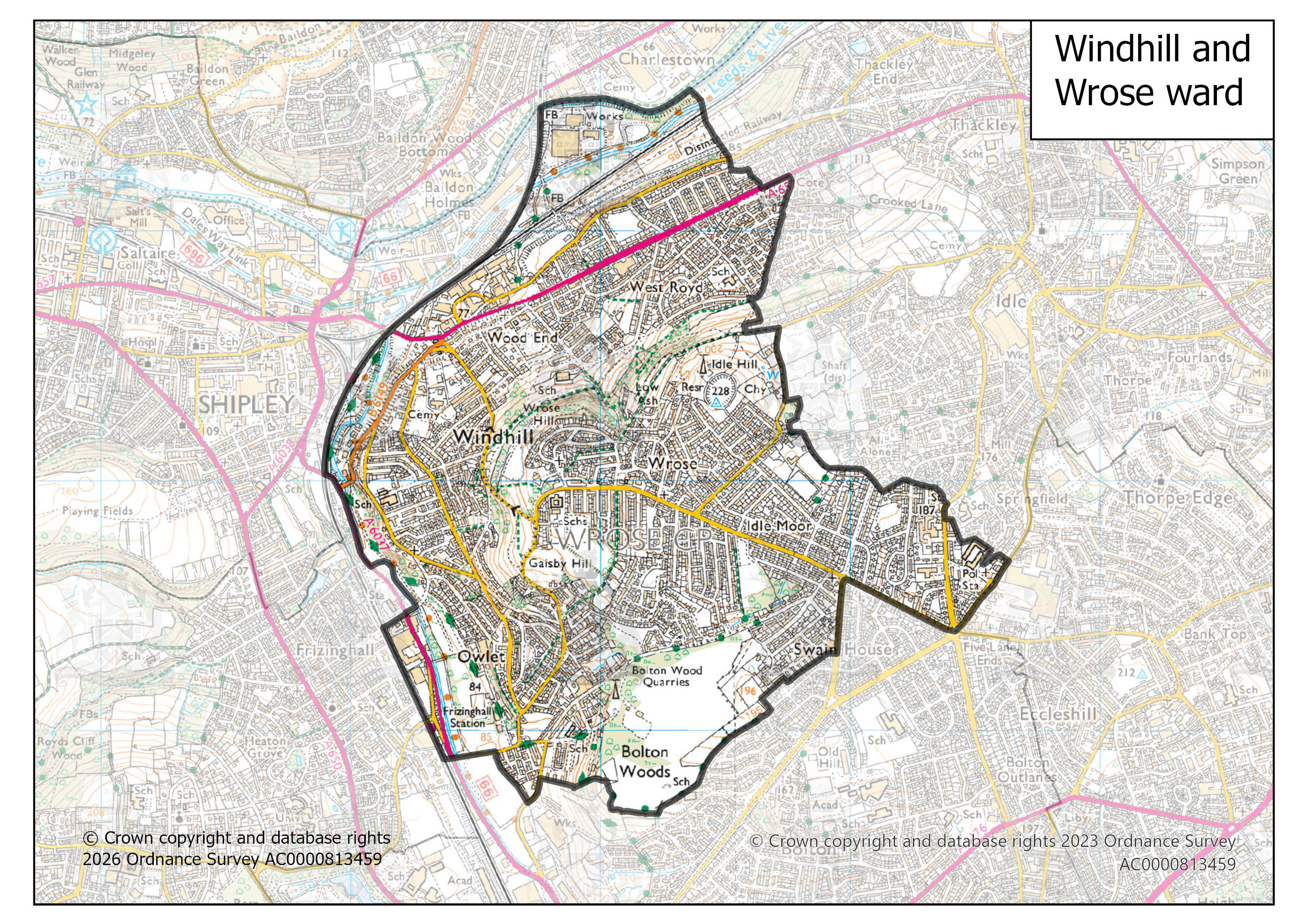
Windhill and Wrose ward map | 1 Mb |
|
|
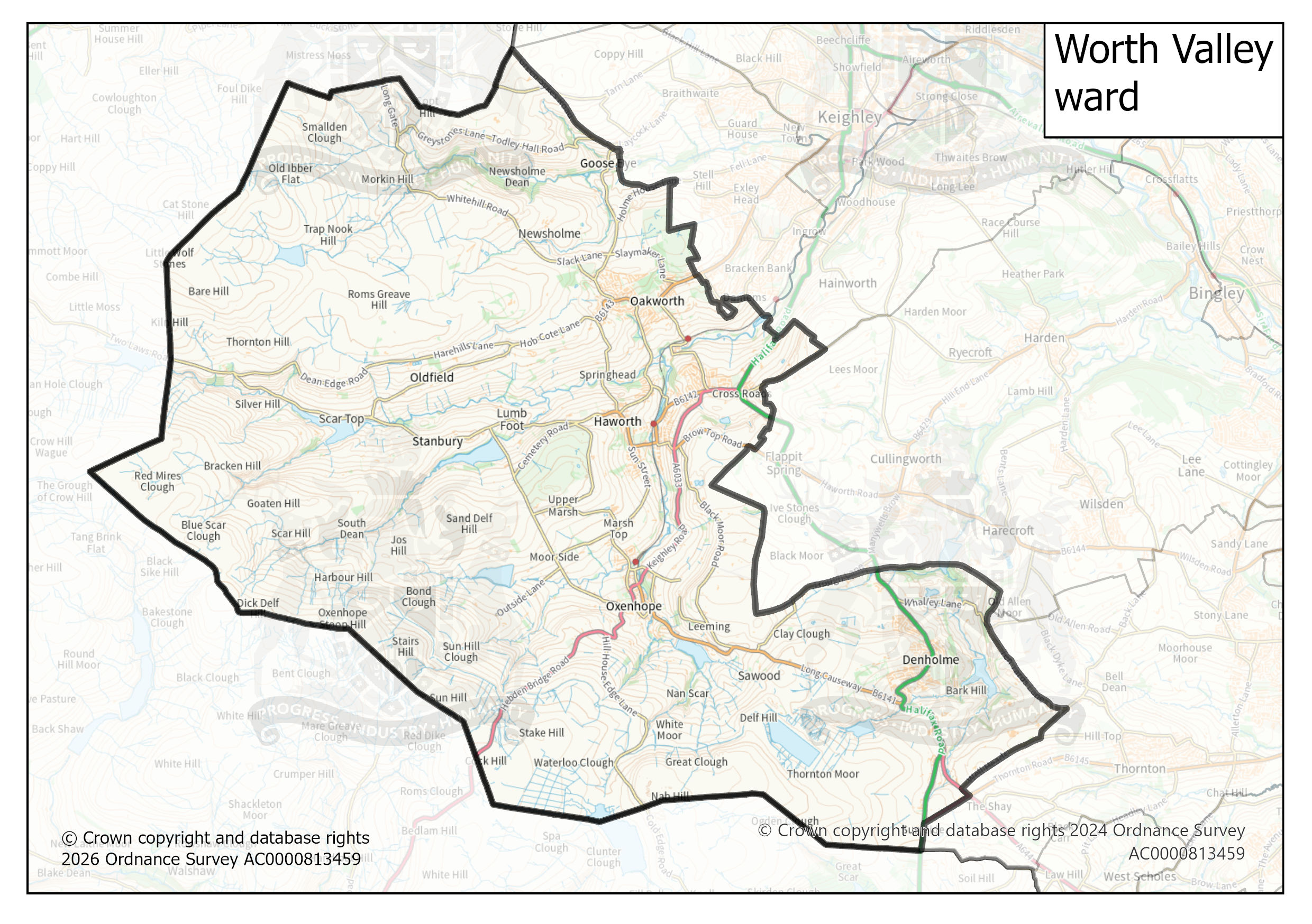
Worth Valley ward map | 758 Kb |
|
|
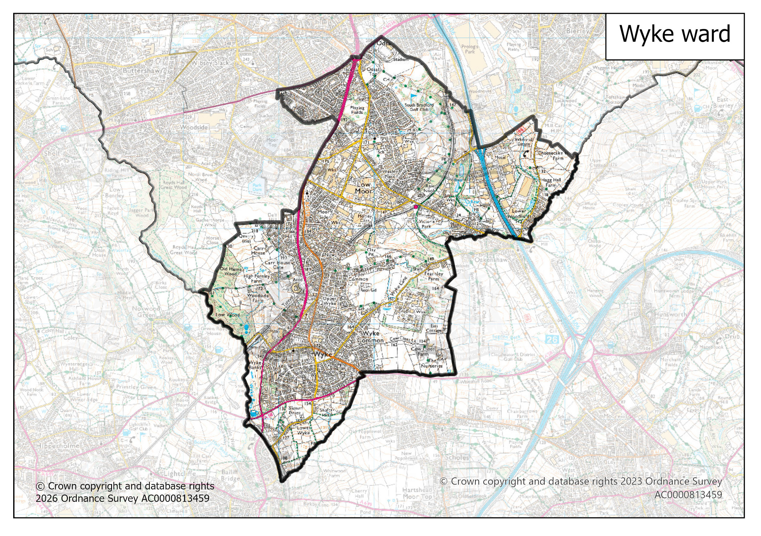
Wyke ward map | 1 Mb |
| File icon | Description | File size |
|---|