Where is the Clean Air Zone?
The Clean Air Zone has been designed to improve air quality in areas where it's worst and where poor air quality is impacting the most on people's health. It will help people to breathe better and reduce other health risks too.
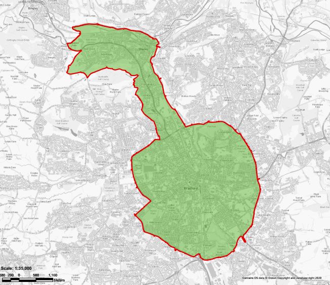
The Bradford zone covers the area inside, and including, the Bradford outer ring road.
It also extends out along the Aire valley corridor, (Manningham Lane/Bradford Road and Canal Road area) to include Shipley and Saltaire.
The image below shows the boundary of the Bradford Clean Air Zone. The red boundary line is included within the Clean Air Zone. To view a full sized map, visit our interactive CAZ map.
Check a location or postcode
If you wish to check specific areas in detail, please use the definitive interactive CAZ map that can be used to check and view a location in the district by road name or postcode.
The Bradford CAZ has a red line boundary. The green shading to indicates an area inside the Bradford CAZ and grey shading for an area outside the Bradford CAZ.
You can use this link to download shape files of the Bradford Clean Air Zone.
The Bradford Clean Air Zone is now live.
- You will need to pay a daily charge to drive in the Bradford Clean Air Zone (CAZ) if your vehicle does not meet required emission standards and is not exempt, find our more on our 'Check if you need to pay' page.
- Check whether charges will apply to your vehicle using your registration number on the government's GOV.UK's vehicle checker.